Skip to Main Content


Looking for IT help?
Recent Articles
By Aaron Vanasse
March 29, 2024 4:37 pm MT
Posted in General CNSIT, Tips and Tricks, Uncategorized, Windows
March 29, 2024 4:37 pm MT
Posted in General CNSIT, Tips and Tricks, Uncategorized, Windows
Open File Explorer In the left hand pane click on This PC At the top of File Explorer click View From the drop down menu select “Add a Network Location” A window will pop up and you can add the path to the drive you want to map <eg> \\pathtomyfolder Make sure to check the […]
Accessible storage in today’s business environment is essential not only as a large-scale storage location but also to enable accessible collaboration from users around the world. While there are arguably better solutions when it comes to safety and security of your data (https://cnsit.colostate.edu/kb/collaboration-and-file-sharing-tools), one cost effective option for groups that require extensive storage is a […]
On some newer Mac devices with M1/M2 chips, running OSX 13.4+, and Echo360 v6.0.773043798+, Echo fails to load its Software Capture application. It will get stuck in a cycle of “applying updates” and then “encountering an error”. Please try the following steps to resolve this: 1. Launch the Terminal application on the Mac.2. Copy/Paste this into […]
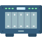
Due to the announcement by Microsoft of upcoming changes in storage offerings – we will want to avoid setting up large scale backup operations to SharePoint sites. More information on this will be emerging soon. https://www.microsoft.com/en-us/education/products/microsoft-365-storage-options Network Attached Storage (NAS) is an inexpensive way to provide shared mass (local-ish) storage to your group. However, without […]
General Information Model: HP Designjet T795Location: CNS Undergraduate Computer Lab in Biology 126Paper: Roll of 36″ HP Plain Paper Poster File Preparation and Requirements Before you attempt to print be sure that your poster file meets the following requirements. 1.) Your poster file must be in the PDF file format.2.) The paper roll is only […]
If you’re off campus and notice that your computer is not receiving updates for Windows or if software that should be available to you is not listed in Software Center these instructions will refresh Software Center allowing you to install the updates or software. In the windows search bar type “disk cleanup” and launch the […]
Once again, we are on the precipice of an Windows operating system upgrade spree. Windows 10 officially loses support by Microsoft in October of 2025. Our goal is to be able to upgrade all possible computers by well before this. Windows 11 Hardware Requirements Microsoft has an official list of all hardware requirements here: https://www.microsoft.com/en-us/windows/windows-11-specifications?r=1 […]
This article is taken/adapted from the following – content reproduced here for posterity: https://www.networkworld.com/article/3618998/using-gimp-to-modify-pdf-files.html Gimp can do everything from resizing and cropping images to adding text, changing colors or distorting images in artistic ways. You can use it to draw with its pencil or paintbrush and layer additional images. It’s quite a versatile tool. Yet […]
Deploying software in the modern age has become very convenient. This is especially true as more of the work force is remote and unable to physically meet with CNSIT staff for required software installations. For machines managed by CNSIT we will be using the Software Center for software deployments as well as OS upgrades and […]
Network drive access can be obtained in three simple steps, provided you don’t mind having to repeat those steps if the connection drops, you restart your Mac, or the device is disconnected: In Finder, either hit Command+K to bring up “Connect to Server” or click Go > Connect to Server Enter the path of the […]